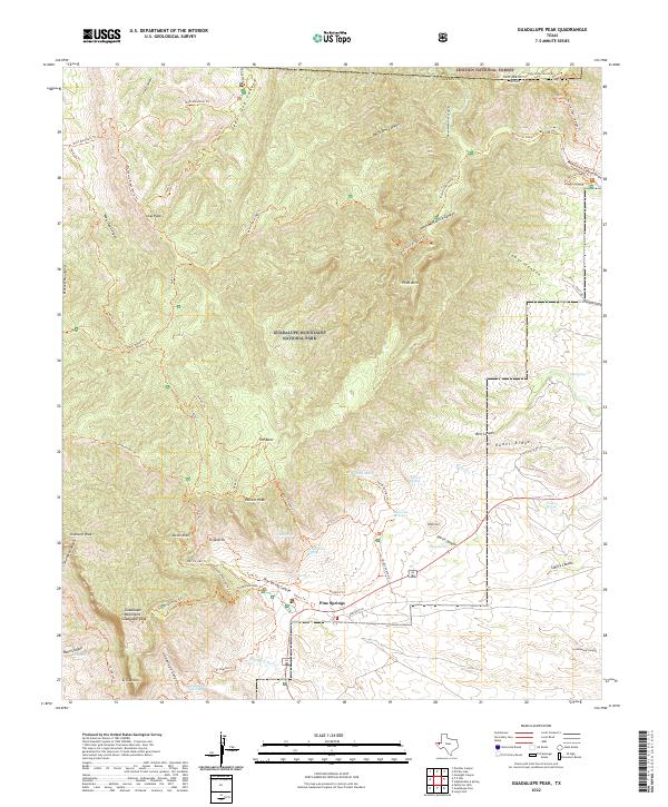
2022 Map of Guadalupe Peak
USGS Topo · Published 2022About this map
Guadalupe Peak rises as the highest point in the state, anchoring a high-altitude landscape defined by steep limestone canyons and a network of desert springs. Within the Guadalupe Mountains National Park, the small settlement of Pine Springs serves as a primary access point, situated near the historic crossing of the Delaware River. The map details a complex web of trails and geological features, including the striking El Capitan and Pratt Arch, which illustrate the region's ancient reef-based origins.
Find a feature on this map
71 named features on this map. Tap any name to fly to it.
Don’t see what you’re looking for? This feature index may not catch every label — zoom into the map to look around manually.
Map Details
Editions of this 2022 Guadalupe Peak Map
This is the sole edition of this map. No revisions or reprints were ever made.
Other maps of this area

1933 · Guadalupe Peak
USGS Topo · 1:48,000

1935 · El Paso Gap
USGS Topo · 1:62,500

1936 · El Paso Gap
USGS Topo · 1:48,000

1940 · El Paso Gap
USGS Topo · 1:62,500

1940 · Guadalupe Peak
USGS Topo · 1:62,500

1940 · Carlsbad Caverns West
USGS Topo · 1:62,500

1943 · Carlsbad Caverns West
USGS Topo · 1:62,500

1954 · Carlsbad
USGS Topo · 1:250,000

1954 · Van Horn
USGS Topo · 1:250,000

1958 · Van Horn
USGS Topo · 1:250,000