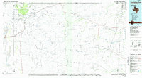
1985 Map of Guadalupe Peak
USGS Topo · Published 1985About this map
Guadalupe Peak and the high limestone escarpments of the Guadalupe Mountains dominate this 1985 survey of West Texas and Southeast New Mexico. The landscape is defined by the transition from the high desert floor of Salt Basin to the protected peaks of Guadalupe Mountains National Park. Evidence of the region's historic transit and resource extraction is scattered throughout, including the historic Butterfield Trail route and the distant Old Michigan Mine.
Find a feature on this map
83 named features on this map. Tap any name to fly to it.
Don’t see what you’re looking for? This feature index may not catch every label — zoom into the map to look around manually.
Map Details
Editions of this 1985 Guadalupe Peak Map
This is the sole edition of this map. No revisions or reprints were ever made.
Other maps of this area

1895 · Sierra Blanca
USGS Topo · 1:125,000

1906 · Van Horn
USGS Topo · 1:125,000

1921 · Toyah
USGS Topo · 1:125,000

1925 · Orla 2-b
USGS Topo · 1:48,000

1928 · Kent
USGS Topo · 1:125,000

1931 · Orla
USGS Topo · 1:62,500

1933 · Guadalupe Peak
USGS Topo · 1:48,000

1935 · El Paso Gap
USGS Topo · 1:62,500

1936 · El Paso Gap
USGS Topo · 1:48,000

1940 · El Paso Gap
USGS Topo · 1:62,500