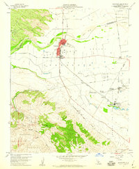
1959 Map of Guadalupe
USGS Topo · Published 1960About this map
The Santa Maria Valley serves as the agricultural and industrial heart of this coastal California region during the late 1950s. The town of Guadalupe is a central hub, where the Southern Pacific railroad meets the Cabrillo Highway. The landscape is a study in transition, from the shifting Sand Dunes near the coast to the organized industrial footprint of the Guadalupe Oil Field and the sugar beet processing infrastructure around Betteravia.
Find a feature on this map
39 named features on this map. Tap any name to fly to it.
Don’t see what you’re looking for? This feature index may not catch every label — zoom into the map to look around manually.
Map Details
Editions of this 1959 Guadalupe Map
4 editions found
Other maps of this area

1897 · Arroyo Grande
USGS Topo · 1:62,500

1900 · San Luis
USGS Topo · 1:125,000

1905 · Guadalupe
USGS Topo · 1:125,000

1905 · Lompoc
USGS Topo · 1:125,000

1922 · Nipomo
USGS Topo · 1:62,500

1942 · Guadalupe
USGS Topo · 1:125,000

1942 · Lompoc
USGS Topo · 1:125,000

1942 · Arroyo Grande
USGS Topo · 1:62,500

1942 · Santa Maria
USGS Topo · 1:62,500

1942 · Point Sal
USGS Topo · 1:62,500