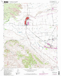
1959 Map of Guadalupe
USGS Topo · Published 1982About this map
The Santa Maria Valley serves as a productive agricultural and industrial corridor in this late 1950s survey, updated with late 1970s revisions. The town of Guadalupe stands as a primary hub, organized around Main Street and the Southern Pacific railroad line. To the southeast, the industrial character of the region is evident at Betteravia, home to the Betteravia Stockyards and Betteravia Junction. This area demonstrates a dense network of specialized infrastructure, including the Carr Scale and numerous oil wells scattered throughout the Guadalupe Oil Field.
Find a feature on this map
56 named features on this map. Tap any name to fly to it.
Don’t see what you’re looking for? This feature index may not catch every label — zoom into the map to look around manually.
Map Details
Editions of this 1959 Guadalupe Map
4 editions found
Other maps of this area

1897 · Arroyo Grande
USGS Topo · 1:62,500

1900 · San Luis
USGS Topo · 1:125,000

1905 · Guadalupe
USGS Topo · 1:125,000

1905 · Lompoc
USGS Topo · 1:125,000

1922 · Nipomo
USGS Topo · 1:62,500

1942 · Guadalupe
USGS Topo · 1:125,000

1942 · Lompoc
USGS Topo · 1:125,000

1942 · Arroyo Grande
USGS Topo · 1:62,500

1942 · Santa Maria
USGS Topo · 1:62,500

1942 · Point Sal
USGS Topo · 1:62,500