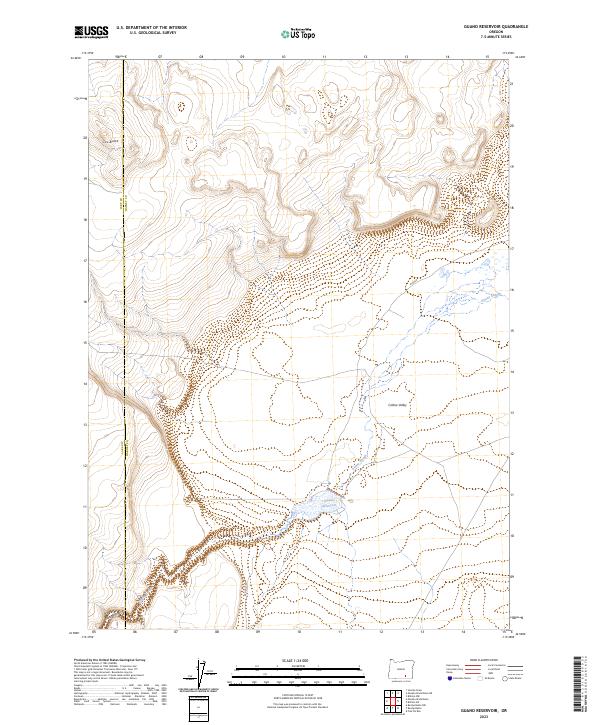
2023 Map of Guano Reservoir
USGS Topo · Published 2023About this map
Guano Reservoir sits at the heart of this high desert landscape, serving as a critical hydrological focal point within the broader Catlow Valley. The drainage patterns are defined by the winding course of Guano Slough, which meanders across the basin toward the reservoir, and the steep descent of Black Canyon to the southwest. This 2023 survey illustrates the remote character of the Harney County interior, where the terrain transitions from the prominent heights of Cox Butte down to the expansive valley floor.
Find a feature on this map
12 named features on this map. Tap any name to fly to it.
Don’t see what you’re looking for? This feature index may not catch every label — zoom into the map to look around manually.
Map Details
Editions of this 2023 Guano Reservoir Map
This is the sole edition of this map. No revisions or reprints were ever made.
Other maps of this area

1955 · Adel
USGS Topo · 1:250,000

1957 · Adel
USGS Topo · 1:250,000

1958 · Adel
USGS Topo · 1:250,000

1962 · Adel
USGS Topo · 1:250,000

1971 · Fish Fin Rim
USGS Topo · 1:24,000

1971 · Beatys Butte
USGS Topo · 1:24,000

1971 · Murphy Waterholes
USGS Topo · 1:24,000
1971 · Sixmile Draw
USGS Topo · 1:24,000
1971 · Guano Reservoir
USGS Topo · 1:24,000
1971 · Blitzen SW
USGS Topo · 1:24,000