Loading...
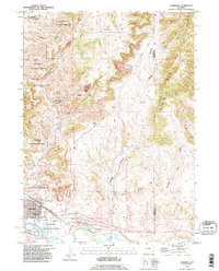
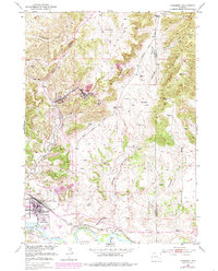
Loading map...1990 Map of Guernsey
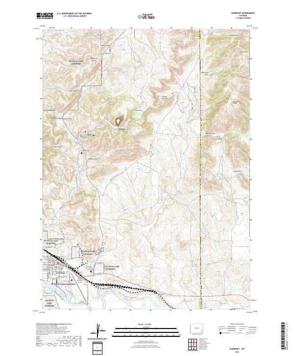
USGS Topo · Published 1995About this map
Industrial iron mining and military training define this corner of Wyoming as it appeared in the late twentieth century. Hartville and Sunrise sit at the heart of a complex mineral landscape, where the Chicago Mine and Good Fortune Mine are surrounded by extensive Quarries and a prominent Mine Dump. To the south, the town of Guernsey anchors the region near the North Platte River, serving as a gateway to the historic Oregon Trail.
Find a feature on this map
45 named features on this map. Tap any name to fly to it.
Don’t see what you’re looking for? This feature index may not catch every label — zoom into the map to look around manually.
Map Details
Date Portrayed1990
Date Published1995
PublisherU.S. Geological Survey
Map TypeTopographic
Scale1:24,000
Physical Dimensions21.6 x 26.8 inches
Editions of this 1990 Guernsey Map
This is the sole edition of this map. No revisions or reprints were ever made.
Historical Maps of Guernsey Through Time
3 maps found
Featured Locations
Source Details
SourceU.S. Geological Survey
CopyrightPublic Domain