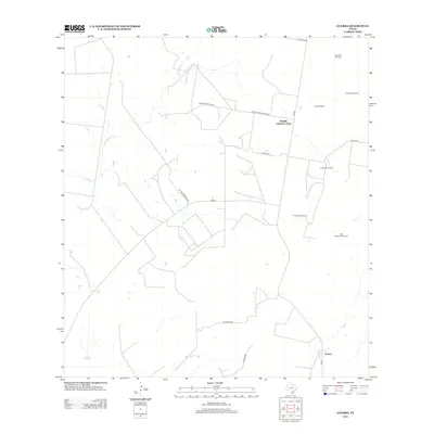
2012 Map of Guerra
USGS Topo · Published 2012About this map
Guerra anchors the southeastern corner of this Jim Hogg County landscape, reflecting the ranching and energy heritage of South Texas in the early twenty-first century. The map illustrates a rural expanse defined by an intricate network of ranch roads and specialized industrial sites, most notably the Colorado Oil Field and the nearby Humble Colorado Camp. Water management is central to the area's utility, evidenced by a series of named landmarks such as Old Medanito Windmill, Chicharon Windmill, and Alto Windmill, which support the dry territory surrounding ephemeral watercourses like Los Tanques Cr and San Juan Cr. The road network, including FM-649 and FM-2687, connects these remote outposts with private ranch tracks like Atonio's Garza Co Rd and La Violeta Rd, showing a land divided between traditional cattle operations and modern mineral extraction.
Find a feature on this map
19 named features on this map. Tap any name to fly to it.
Don’t see what you’re looking for? This feature index may not catch every label — zoom into the map to look around manually.
Map Details
Editions of this 2012 Guerra Map
This is the sole edition of this map. No revisions or reprints were ever made.
Other maps of this area

1938 · Cuevitas
USGS Topo · 1:62,500

1939 · Randado
USGS Topo · 1:62,500

1940 · Randado
USGS Topo · 1:62,500

1940 · Mogotes Hill
USGS Topo · 1:62,500

1949 · Mc Allen
USGS Topo · 1:250,000

1954 · McAllen
USGS Topo · 1:250,000

1956 · Mogotes Hill
USGS Topo · 1:62,500

1956 · Arroyo Clareno
USGS Topo · 1:62,500

1956 · Laredo
USGS Topo · 1:250,000

1957 · Mc Allen
USGS Topo · 1:250,000