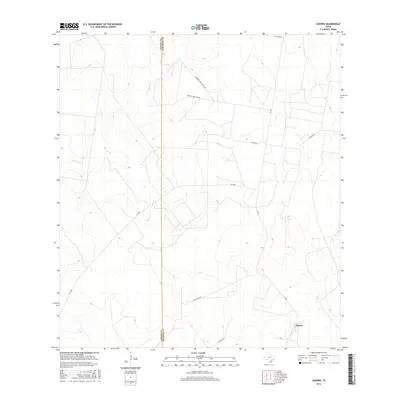
2016 Map of Guerra
USGS Topo · Published 2016About this map
The settlement of Guerra sits in the southeastern corner of this Jim Hogg County landscape, positioned near the intersection of FM 649 and Encantada Rd. This 2016 survey illustrates a South Texas ranching environment defined by wide seasonal drainage systems and private road networks. The boundary between Zapata County and Jim Hogg County runs vertically through the western half of the quadrangle, crossing the upper reaches of Los Tanques Cr.
Find a feature on this map
12 named features on this map. Tap any name to fly to it.
Don’t see what you’re looking for? This feature index may not catch every label — zoom into the map to look around manually.
Map Details
Editions of this 2016 Guerra Map
This is the sole edition of this map. No revisions or reprints were ever made.
Other maps of this area

1938 · Cuevitas
USGS Topo · 1:62,500

1939 · Randado
USGS Topo · 1:62,500

1940 · Randado
USGS Topo · 1:62,500

1940 · Mogotes Hill
USGS Topo · 1:62,500

1949 · Mc Allen
USGS Topo · 1:250,000

1954 · McAllen
USGS Topo · 1:250,000

1956 · Mogotes Hill
USGS Topo · 1:62,500

1956 · Arroyo Clareno
USGS Topo · 1:62,500

1956 · Laredo
USGS Topo · 1:250,000

1957 · Mc Allen
USGS Topo · 1:250,000