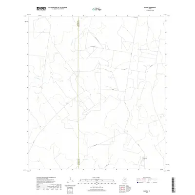
2019 Map of Guerra
USGS Topo · Published 2019About this map
Guerra serves as the primary population center in this South Texas landscape, situated near the intersection of FM 649 and La Leona Rd. The area is defined by its deep ranching heritage, evidenced by numerous named tracks including Antonio Garza Ranch Rd and Atonio's Garza Co Rd, which navigate the drainage basins of Los Tanques Cr and San Juan Cr. The terrain is marked by a network of ranch roads like E Ranch Rd and Encantada Rd that connect isolated properties across the brush country. This survey also records the political boundary between Zapata and Jim Hogg Counties, a line that bisects the western portion of the quadrangle and influences the local road grid and land management patterns of the early 21st century.
Find a feature on this map
12 named features on this map. Tap any name to fly to it.
Don’t see what you’re looking for? This feature index may not catch every label — zoom into the map to look around manually.
Map Details
Editions of this 2019 Guerra Map
This is the sole edition of this map. No revisions or reprints were ever made.
Other maps of this area

1938 · Cuevitas
USGS Topo · 1:62,500

1939 · Randado
USGS Topo · 1:62,500

1940 · Randado
USGS Topo · 1:62,500

1940 · Mogotes Hill
USGS Topo · 1:62,500

1949 · Mc Allen
USGS Topo · 1:250,000

1954 · McAllen
USGS Topo · 1:250,000

1956 · Mogotes Hill
USGS Topo · 1:62,500

1956 · Arroyo Clareno
USGS Topo · 1:62,500

1956 · Laredo
USGS Topo · 1:250,000

1957 · Mc Allen
USGS Topo · 1:250,000