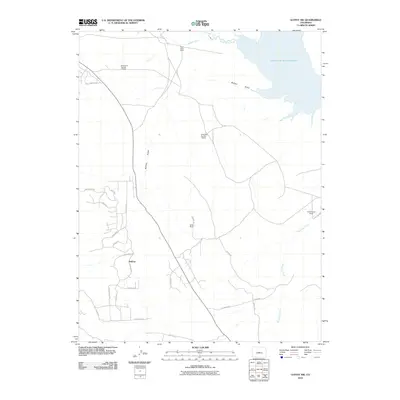
2010 Map of Guffey NW
USGS Topo · Published 2010About this map
Balfour Mines and the settlement of Balfour anchor this section of Park County, where the high mountain landscape meets the waters of the South Platte River. The area is defined by a network of established ranching operations, including the Pabst-Howe Ranch, Richardson Number 1 Ranch, and Wiedersphan Ranch. In the northeast, the Spinney Mountain Reservoir provides a significant hydrological feature, fed by the river and the Western Ditch. The southern half of the map reveals a transition toward more modern residential development, with street names like Chickadee Dr and Cherokee Rd branching off from Comstick Rd. This layout illustrates the evolution of the land from its mineral and livestock roots toward contemporary rural habitation, while drainage features like Buffalo Gulch and Threemile Creek continue to shape the local topography.
Find a feature on this map
32 named features on this map. Tap any name to fly to it.
Don’t see what you’re looking for? This feature index may not catch every label — zoom into the map to look around manually.
Map Details
Editions of this 2010 Guffey NW Map
This is the sole edition of this map. No revisions or reprints were ever made.
Other maps of this area

1953 · Denver
USGS Topo · 1:250,000

1954 · Pueblo
USGS Topo · 1:250,000

1956 · Sulphur Mountain
USGS Topo · 1:24,000

1956 · Antero Reservoir NE
USGS Topo · 1:24,000

1956 · Hartsel
USGS Topo · 1:24,000

1956 · Guffey NW
USGS Topo · 1:24,000

1956 · Glentivar
USGS Topo · 1:24,000

1956 · Spinney Mountain
USGS Topo · 1:24,000

1957 · Denver
USGS Topo · 1:250,000

1957 · Pueblo
USGS Topo · 1:250,000