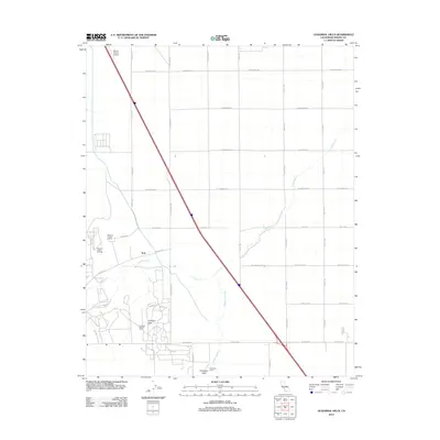
2012 Map of Guijarral Hills
USGS Topo · Published 2012About this map
The industrial energy landscape of Fresno County dominates this area, characterized by the extensive operations of the Pleasant Valley Oil Field and the Guijarral Hills Oil Field. These fields are situated near the prominent Guijarral Hills, where a dense network of service roads and pipeline corridors supports the local petroleum economy. The topography is defined by the passage of Los Gatos Cr and Zapato Chino Cr, which cut through the arid valley floor toward the Polvadero Gap. Agriculture and aviation also mark the territory, with the Harris Ranch Airport providing a vital transport link alongside the Pleasant Valley Ranch. The regular grid of county roads, including W Mitchell Ave and W Jayne Ave, illustrates the transition from open grazing land to high-output industrial zones in the early 21st century.
Find a feature on this map
27 named features on this map. Tap any name to fly to it.
Don’t see what you’re looking for? This feature index may not catch every label — zoom into the map to look around manually.
Map Details
Editions of this 2012 Guijarral Hills Map
This is the sole edition of this map. No revisions or reprints were ever made.
Other maps of this area

1912 · Coalinga
USGS Topo · 1:125,000

1928 · Delta Farms No 3
USGS Topo · 1:31,680

1930 · Discovery Well
USGS Topo · 1:31,680

1930 · Canoas Creek
USGS Topo · 1:31,680

1932 · Delta Farms
USGS Topo · 1:31,680

1932 · West of Lethent
USGS Topo · 1:31,680

1933 · Huron
USGS Topo · 1:31,680

1933 · Guijarral Hills
USGS Topo · 1:31,680
1934 · La Cima
USGS Topo · 1:31,680

1934 · Canoas Creek
USGS Topo · 1:31,680