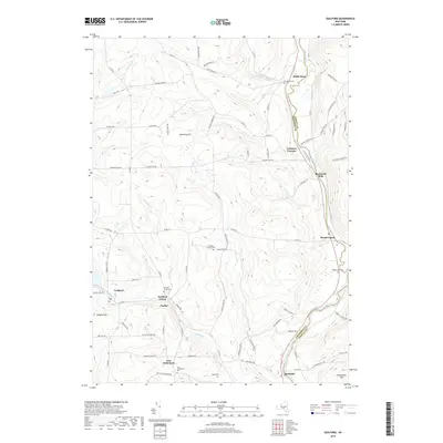
2019 Map of Guilford
USGS Topo · Published 2019About this map
The Unadilla River carves a deep valley through the Chenango and Otsego county border, anchoring a landscape of upland ridges and clustered creek-side hamlets. In the late 2010s, this area retains its traditional settlement patterns, with concentrations of dwellings at White Store, Rockwells Mills, and Mount Upton along the river's western bank. The rugged terrain to the west is defined by high points like Shumway Hill and Breffel Hill, where numerous small cemeteries such as Godfrey Corners Cem and the Foote Cem sit along winding country roads.
Find a feature on this map
88 named features on this map. Tap any name to fly to it.
Don’t see what you’re looking for? This feature index may not catch every label — zoom into the map to look around manually.
Map Details
Editions of this 2019 Guilford Map
This is the sole edition of this map. No revisions or reprints were ever made.
Other maps of this area

1902 · Coventry
USGS Topo · 1:62,500

1903 · Norwich
USGS Topo · 1:62,500

1904 · Oxford
USGS Topo · 1:62,500

1910 · New Berlin
USGS Topo · 1:62,500

1912 · New Berlin
USGS Topo · 1:62,500

1915 · Unadilla
USGS Topo · 1:62,500

1918 · Unadilla
USGS Topo · 1:62,500

1943 · Sidney
USGS Topo · 1:24,000

1943 · New Berlin South
USGS Topo · 1:24,000

1943 · Gilbertsville
USGS Topo · 1:24,000