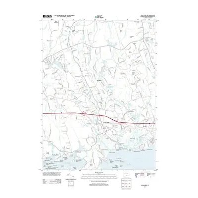
2012 Map of Guilford
USGS Topo · Published 2012About this map
Guilford sits at the heart of this coastal landscape, where the Amtrak rail line follows the shoreline and connects the village to historic outposts like Leetes Island and Stony Creek. The map illustrates a complex coastal geography defined by Hoadley Neck and a dense archipelago of small landforms including Bear Island, Beers Island, and Mermaid Rock. Inland, the terrain rises toward Nut Plains and the heights of Hungry Hill, with development spreading along established routes like Peddlers Rd.
Find a feature on this map
203 named features on this map. Tap any name to fly to it.
Don’t see what you’re looking for? This feature index may not catch every label — zoom into the map to look around manually.
Map Details
Editions of this 2012 Guilford Map
This is the sole edition of this map. No revisions or reprints were ever made.
Other maps of this area

1892 · New Haven
USGS Topo · 1:62,500

1893 · Guilford
USGS Topo · 1:62,500

1921 · New Haven
USGS Topo · 1:62,500

1943 · Durham
USGS Topo · 1:25,000

1947 · Hartford
USGS Topo · 1:250,000

1948 · Hartford
USGS Topo · 1:250,000

1951 · Clinton
USGS Topo · 1:31,680

1952 · Haddam
USGS Topo · 1:31,680

1953 · Durham
USGS Topo · 1:31,680

1954 · Guilford
USGS Topo · 1:31,680