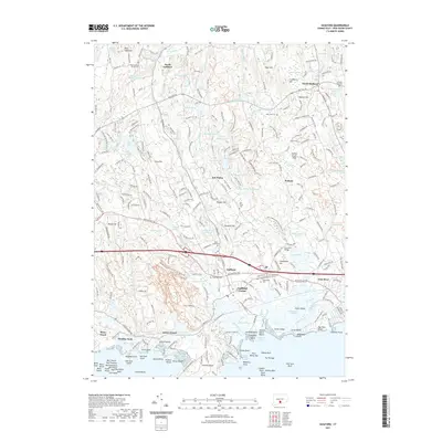
2021 Map of Guilford
USGS Topo · Published 2021About this map
Guilford and its historic center dominate this shoreline landscape, where the town's dense residential grid meets the tidal marshes of Guilford Harbor. The area's settlement history is deeply engraved in the landscape through numerous burial grounds, from the Old Guilford North Cem in the north to Alderbrook Cem near the town center. Industrial and agricultural roots are visible in features like the Town Millpond and Witch Hazel Millpond, while the southern shoreline at Sachem Head and Leetes Island reveals a complex network of points and coves along Long Island Sound. This modern record shows the persistent presence of the Amtrak rail line and the Boston Post Road, which follow ancient coastal corridors. Inland, the topography transitions to the elevations of Hungry Hill and Prospect Hill, interspersed with natural wetlands like Beaver Head Swamp.
Find a feature on this map
126 named features on this map. Tap any name to fly to it.
Don’t see what you’re looking for? This feature index may not catch every label — zoom into the map to look around manually.
Map Details
Editions of this 2021 Guilford Map
This is the sole edition of this map. No revisions or reprints were ever made.
Other maps of this area

1892 · New Haven
USGS Topo · 1:62,500

1893 · Guilford
USGS Topo · 1:62,500

1921 · New Haven
USGS Topo · 1:62,500

1943 · Durham
USGS Topo · 1:25,000

1947 · Hartford
USGS Topo · 1:250,000

1948 · Hartford
USGS Topo · 1:250,000

1951 · Clinton
USGS Topo · 1:31,680

1952 · Haddam
USGS Topo · 1:31,680

1953 · Durham
USGS Topo · 1:31,680

1954 · Guilford
USGS Topo · 1:31,680