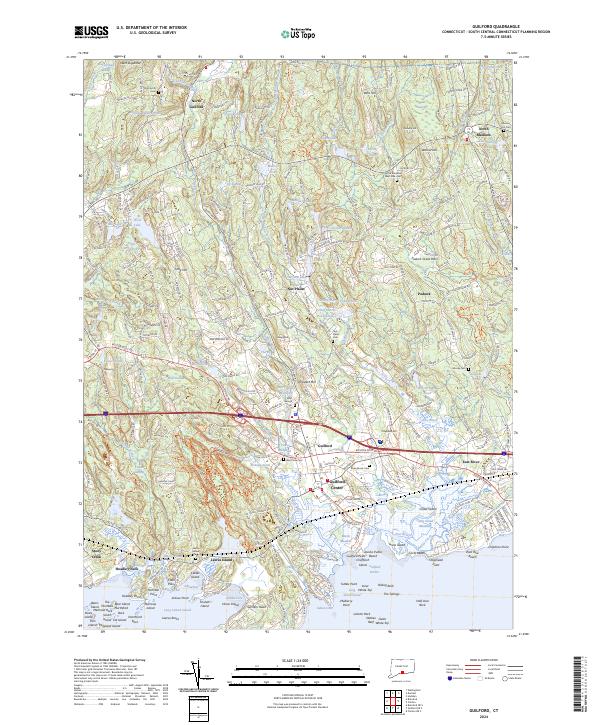
2024 Map of Guilford
USGS Topo · Published 2024About this map
Guilford and its surrounding coastal villages are depicted here in detail, showcasing a landscape where colonial-era settlement patterns meet the modern shoreline. The map documents the historic core of Guilford Center and the outlying hamlets of North Guilford, Nut Plains, and Podunk. Along the coast, the intricate geography of Long Island Sound is visible through features like Sachem Head, Hoadley Neck, and the cluster of islands near Leetes Island. This coastal region is defined by a complex network of salt marshes and rocky points, including Grass Island and Mulberry Point. Interior areas are characterized by numerous small bodies of water such as Guilford Lake and Dream Lake, alongside several historic burial grounds including Saint George Cem and Alder Brook Cem. The presence of the Amtrak line and the Boston Post RD underscores the long-standing importance of this corridor for regional transit between New York and Boston.
Find a feature on this map
108 named features on this map. Tap any name to fly to it.
Don’t see what you’re looking for? This feature index may not catch every label — zoom into the map to look around manually.
Map Details
Editions of this 2024 Guilford Map
This is the sole edition of this map. No revisions or reprints were ever made.
Other maps of this area

1892 · New Haven
USGS Topo · 1:62,500

1893 · Guilford
USGS Topo · 1:62,500

1921 · New Haven
USGS Topo · 1:62,500

1943 · Durham
USGS Topo · 1:25,000

1947 · Hartford
USGS Topo · 1:250,000

1948 · Hartford
USGS Topo · 1:250,000

1951 · Clinton
USGS Topo · 1:31,680

1952 · Haddam
USGS Topo · 1:31,680

1953 · Durham
USGS Topo · 1:31,680

1954 · Guilford
USGS Topo · 1:31,680