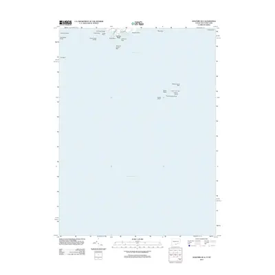
2012 Map of Guilford OE S
USGS Topo · Published 2012About this map
Falkner Island Light stands as the primary navigational beacon within this coastal expanse of Long Island Sound. The map focuses heavily on the maritime hazards and geological features of the sound, documenting a series of significant reefs and rock formations such as Chimney Corner Reef, Falkner Island Reef, and Charles Reef. These submerged features, along with Goose Rocks Shoals, define the nautical character of the waters south of the Connecticut shoreline.
Find a feature on this map
24 named features on this map. Tap any name to fly to it.
Don’t see what you’re looking for? This feature index may not catch every label — zoom into the map to look around manually.
Map Details
Editions of this 2012 Guilford OE S Map
This is the sole edition of this map. No revisions or reprints were ever made.
Other maps of this area

1892 · New Haven
USGS Topo · 1:62,500

1893 · Guilford
USGS Topo · 1:62,500

1921 · New Haven
USGS Topo · 1:62,500

1947 · Mattituck Hills
USGS Topo · 1:24,000

1947 · Hartford
USGS Topo · 1:250,000

1948 · Hartford
USGS Topo · 1:250,000

1951 · Clinton
USGS Topo · 1:31,680

1954 · Guilford
USGS Topo · 1:31,680
1954 · Branford
USGS Topo · 1:31,680
1956 · Mattituck Hills
USGS Topo · 1:24,000