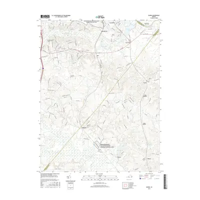
2016 Map of Guinea
USGS Topo · Published 2016About this map
Fredericksburg and Spotsylvania National Military Park preserves significant portions of this historic landscape, where the terrain is marked by the winding courses of the Po River and Massaponax Cr. This 2016 survey highlights the intersection of modern educational growth and deep-rooted heritage, anchored by the Germanna Community Coll Fredericksburg Campus. The rural character of the region is evident in the many small crossroads and communities like Massaponax, New Post, and Daltons. Local genealogy and land-use history are well-documented through numerous family and congregational burial grounds, including Second New Hope Cem, Macedonia Cem, and Hopewell Cem. Waterways such as the Rappahannock River and Dalton Millpond continue to shape the geography of these borderlands between Spotsylvania and Caroline counties, reflecting a landscape that has balanced preservation with residential expansion.
Find a feature on this map
139 named features on this map. Tap any name to fly to it.
Don’t see what you’re looking for? This feature index may not catch every label — zoom into the map to look around manually.
Map Details
Editions of this 2016 Guinea Map
This is the sole edition of this map. No revisions or reprints were ever made.
Other maps of this area

1887 · Spottsylvania
USGS Topo · 1:125,000

1889 · Fredericksburg
USGS Topo · 1:125,000

1892 · Fredericksburg
USGS Topo · 1:125,000

1892 · Spottsylvania
USGS Topo · 1:125,000

1894 · Fredericksburg
USGS Topo · 1:125,000

1926 · Stafford
USGS Topo · 1:62,500

1931 · Stafford
USGS Topo · 1:62,500

1942 · Bowling Green
USGS Topo · 1:31,680

1942 · Woodford
USGS Topo · 1:31,680

1942 · Guinea
USGS Topo · 1:31,680