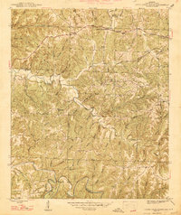
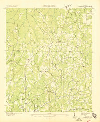
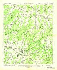
1947 Map of Guinn Cross Roads
USGS Topo · Published 1947About this map
Little Bear Creek and its many winding tributaries define this portion of Franklin County during the mid-1940s. The landscape is characterized by a dense network of rural settlements and named hollows, reflecting a well-established agrarian community. Local crossroads like Guinn Cross Roads and Dempsey served as focal points for residents, while numerous houses of worship such as Bradley Chapel and Macedonia Ch suggest the importance of local parishes. The terrain is notably dissected, evidenced by distinctive features like Jacobs Ladder Bluff and the dramatic bends in the water such as Piney Bend and Horseshoe Bend. Transportation follows the contours of the land, with the Cotton Road cutting through the hills. For genealogists, the map is a detailed record of family-named landmarks and several burial grounds, including Friendship Cem and Baggett Cem.
Find a feature on this map
68 named features on this map. Tap any name to fly to it.
Don’t see what you’re looking for? This feature index may not catch every label — zoom into the map to look around manually.
Map Details
Editions of this 1947 Guinn Cross Roads Map
2 editions found
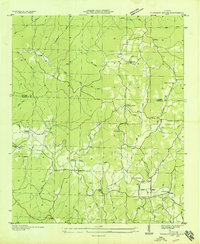
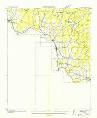
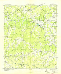
Other maps of this area

1925 · Barton
USGS Topo · 1:62,500

1926 · Barton
USGS Topo · 1:48,000
1929 · Barton
USGS Topo · 1:62,500
1935 · Pleasant Site
USGS Topo · 1:24,000
1936 · Frankfort
USGS Topo · 1:24,000
1936 · Pleasant Grove
USGS Topo · 1:24,000
1936 · Hodges
USGS Topo · 1:24,000
1936 · Isbell
USGS Topo · 1:24,000
1936 · Hackleburg
USGS Topo · 1:24,000
1936 · Vina
USGS Topo · 1:24,000