
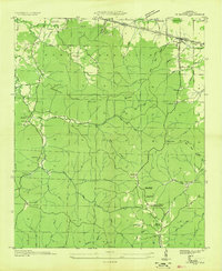
1936 Map of Pleasant Grove
USGS Topo · Published 1936About this map
The boundary between Colbert Co and Franklin Co divides a landscape defined by its complex network of watercourses in the mid-1930s. The Tennessee Valley Authority and the Geological Survey documented this rural area just as modern road infrastructure was beginning to solidify around older fords and crossings. Named river crossings like Burgess Bridge, Thorn Bridge, and Slick Rock Ford reveal the essential points of travel in a territory etched by Cedar Creek, Rock Creek, and Buzzard Roost Creek.
Find a feature on this map
46 named features on this map. Tap any name to fly to it.
Don’t see what you’re looking for? This feature index may not catch every label — zoom into the map to look around manually.
Map Details
Editions of this 1936 Pleasant Grove Map
This is the sole edition of this map. No revisions or reprints were ever made.
Other maps of this area

1925 · Barton
USGS Topo · 1:62,500

1926 · Barton
USGS Topo · 1:48,000

1929 · Barton
USGS Topo · 1:62,500

1935 · Pleasant Site
USGS Topo · 1:24,000

1936 · Frankfort
USGS Topo · 1:24,000

1936 · Isbell
USGS Topo · 1:24,000

1936 · Pride
USGS Topo · 1:24,000
1936 · Barton
USGS Topo · 1:24,000

1936 · Halltown
USGS Topo · 1:24,000

1936 · Bishop
USGS Topo · 1:24,000