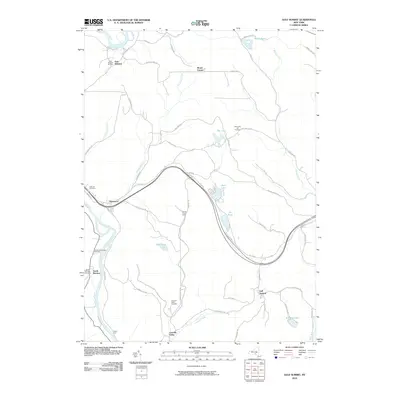
2010 Map of Gulf Summit
USGS Topo · Published 2010About this map
The Susquehanna River winds through the western edge of this landscape, anchoring a series of small settlements including East Windsor and South Windsor. Further east, the terrain is defined by numerous small water bodies such as Sky Lake, Deer Lake, and Fly Pond, which sit along the drainages of Tuscarora Creek and Fly Creek. The area’s historical footprint is remarkably visible through its many burial grounds, ranging from the Alexander Hill Cemetery in the north to the Cascade Valley Cemetery near the southern border.
Find a feature on this map
62 named features on this map. Tap any name to fly to it.
Don’t see what you’re looking for? This feature index may not catch every label — zoom into the map to look around manually.
Map Details
Editions of this 2010 Gulf Summit Map
This is the sole edition of this map. No revisions or reprints were ever made.
Other maps of this area

1905 · Nineveh
USGS Topo · 1:62,500

1924 · Starrucca
USGS Topo · 1:48,000

1924 · Deposit
USGS Topo · 1:62,500

1926 · Deposit
USGS Topo · 1:62,500

1926 · Starrucca
USGS Topo · 1:62,500

1930 · Starrucca
USGS Topo · 1:48,000

1932 · Susquehanna
USGS Topo · 1:62,500

1933 · Starrucca
USGS Topo · 1:62,500

1935 · Susquehanna
USGS Topo · 1:62,500

1943 · Honesdale
USGS Topo · 1:125,000