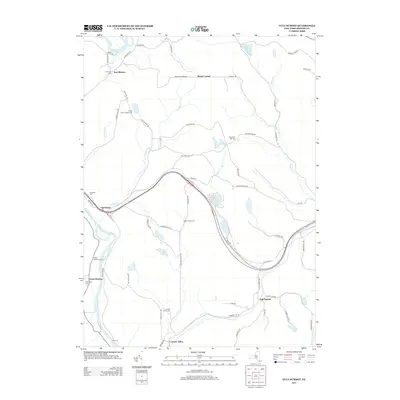
2013 Map of Gulf Summit
USGS Topo · Published 2013About this map
The Susquehanna River cuts through the western edge of this landscape, marking a low-lying corridor where South Windsor and Damascus are situated. This area preserves a high concentration of pioneer and family burial grounds, including the Old S Windsor Cem, Edwards Cem, and Alexander Hill Cem, which offer significant value for genealogical research in this portion of Broome County. To the east, the terrain rises toward the namesake settlement of Gulf Summit and the small hamlet of Cascade Valley, connected by a network of winding mountain roads.
Find a feature on this map
69 named features on this map. Tap any name to fly to it.
Don’t see what you’re looking for? This feature index may not catch every label — zoom into the map to look around manually.
Map Details
Editions of this 2013 Gulf Summit Map
This is the sole edition of this map. No revisions or reprints were ever made.
Other maps of this area

1905 · Nineveh
USGS Topo · 1:62,500

1924 · Starrucca
USGS Topo · 1:48,000

1924 · Deposit
USGS Topo · 1:62,500

1926 · Deposit
USGS Topo · 1:62,500

1926 · Starrucca
USGS Topo · 1:62,500

1930 · Starrucca
USGS Topo · 1:48,000

1932 · Susquehanna
USGS Topo · 1:62,500

1933 · Starrucca
USGS Topo · 1:62,500

1935 · Susquehanna
USGS Topo · 1:62,500

1943 · Honesdale
USGS Topo · 1:125,000