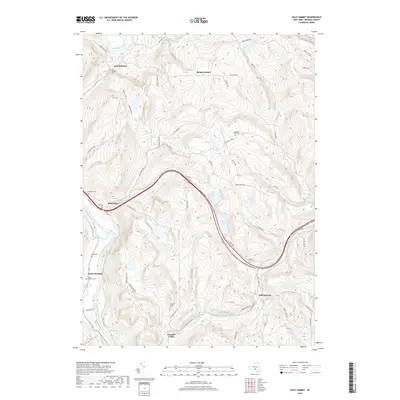
2019 Map of Gulf Summit
USGS Topo · Published 2019About this map
The Susquehanna River flows through the western edge of this Broome County landscape, anchoring several small rural communities and family burial grounds. High-elevation settlements such as Gulf Summit and Cascade Valley are situated among the steep ridges and narrow creek valleys, while East Windsor and South Windsor parallel the river's course. Genealogy researchers will find numerous small cemeteries, including South Windsor Cem, Wake Cem, and Alexander Hill Cem, scattered across the uplands. The terrain is defined by its water bodies, from larger features like Sky Lake and Deer Lake to Fly Pond and Mud Pond. A prominent transit corridor follows the valley through Damascus, crossing several small tributaries such as Tuscarora Cr and Cascade Cr. This map reveals a late-2010s perspective on a traditional New York highland area where small-scale settlements persist alongside significant natural landmarks like Alexander Hill.
Find a feature on this map
66 named features on this map. Tap any name to fly to it.
Don’t see what you’re looking for? This feature index may not catch every label — zoom into the map to look around manually.
Map Details
Editions of this 2019 Gulf Summit Map
This is the sole edition of this map. No revisions or reprints were ever made.
Other maps of this area

1905 · Nineveh
USGS Topo · 1:62,500

1924 · Starrucca
USGS Topo · 1:48,000

1924 · Deposit
USGS Topo · 1:62,500

1926 · Deposit
USGS Topo · 1:62,500

1926 · Starrucca
USGS Topo · 1:62,500

1930 · Starrucca
USGS Topo · 1:48,000

1932 · Susquehanna
USGS Topo · 1:62,500

1933 · Starrucca
USGS Topo · 1:62,500

1935 · Susquehanna
USGS Topo · 1:62,500

1943 · Honesdale
USGS Topo · 1:125,000