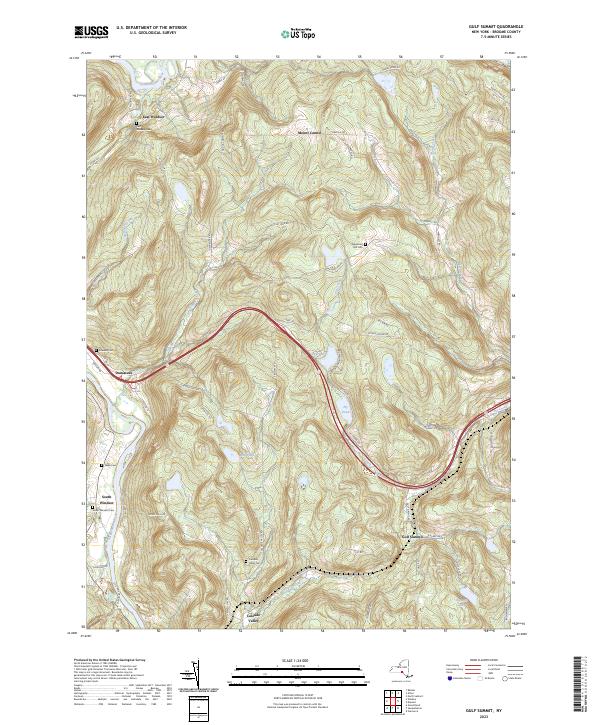
2023 Map of Gulf Summit
USGS Topo · Published 2023About this map
The Susquehanna River winds through the northwestern corner of this Broome County landscape, anchoring the settlements of East Windsor and South Windsor. Further south, the high ground of the Gulf Summit area gives way to a network of steep drainages, including the headwaters of Fly Creek and Cascade Creek. The terrain is marked by numerous family and community burial grounds, such as East Windsor Cem, Edwards Cem, and the Alexander Hill Cem situated near the quiet waters of Sky Lake. This 2023 survey illustrates the enduring rural character of the region, where narrow roads like Flat Iron Rd and Gresson Hill Rd follow the contours of the upland plateaus. Local history is etched into the landscape at sites like Cascade Valley, where the Cascade Valley Cem serves as a silent record of the area's early residents along the border of the Pennsylvania line.
Find a feature on this map
66 named features on this map. Tap any name to fly to it.
Don’t see what you’re looking for? This feature index may not catch every label — zoom into the map to look around manually.
Map Details
Editions of this 2023 Gulf Summit Map
This is the sole edition of this map. No revisions or reprints were ever made.
Other maps of this area

1905 · Nineveh
USGS Topo · 1:62,500

1924 · Starrucca
USGS Topo · 1:48,000

1924 · Deposit
USGS Topo · 1:62,500

1926 · Deposit
USGS Topo · 1:62,500

1926 · Starrucca
USGS Topo · 1:62,500

1930 · Starrucca
USGS Topo · 1:48,000

1932 · Susquehanna
USGS Topo · 1:62,500

1933 · Starrucca
USGS Topo · 1:62,500

1935 · Susquehanna
USGS Topo · 1:62,500

1943 · Honesdale
USGS Topo · 1:125,000