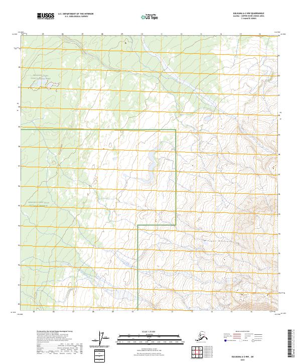
2023 Map of Gulkana A-2 NW
USGS Topo · Published 2023About this map
The Wrangell Mountains dominate this 2023 survey of interior Alaska, where the landscape is defined by vast protected acreages and the high peaks of the copper-rich Copper River Basin. This specific quadrangle maps the intersection of three distinct federal land designations: the Wrangell-Saint Elias National Park, the highly protected Wrangell-St. Elias Wilderness, and the Wrangell-Saint Elias National Preserve. The map illustrates the complex administrative geography used to manage these remote northern ecosystems, showing the boundaries between various townships such as t5n r2e and t4n r3e. For researchers, this document serves as a modern baseline for the drainage patterns and glaciated terrain of the Wrangell range before further environmental shifts occur.
Find a feature on this map
12 named features on this map. Tap any name to fly to it.
Don’t see what you’re looking for? This feature index may not catch every label — zoom into the map to look around manually.
Map Details
Editions of this 2023 Gulkana A-2 NW Map
This is the sole edition of this map. No revisions or reprints were ever made.
Other maps of this area

1949 · Gulkana A-3
USGS Topo · 1:63,360

1949 · Gulkana B-2
USGS Topo · 1:63,360

1950 · Gulkana B-3
USGS Topo · 1:63,360

1951 · Gulkana
USGS Topo · 1:250,000

1952 · Gulkana A-3
USGS Topo · 1:63,360

1952 · Gulkana B-3
USGS Topo · 1:63,360

1952 · Gulkana B-2
USGS Topo · 1:63,360
1959 · Gulkana A-2
USGS Topo · 1:63,360

1959 · Gulkana
USGS Topo · 1:250,000

1965 · Gulkana
USGS Topo · 1:250,000