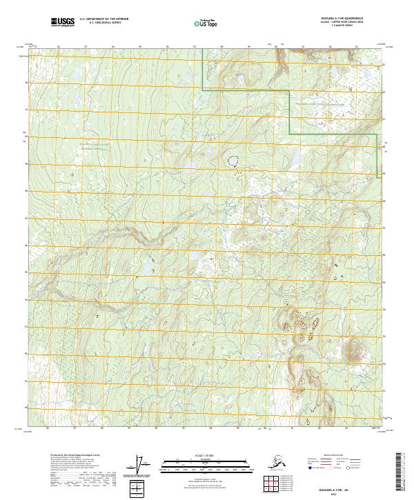
2023 Map of Gulkana A-3 NE
USGS Topo · Published 2023About this map
Wrangell-Saint Elias National Park and the adjacent Wrangell-Saint Elias National Preserve dominate this high-latitude Alaskan landscape. The terrain is defined by a dense network of unnamed wetlands and small glacial ponds that permeate the northern reaches of the Copper River Census Area. This contemporary survey by the U.S. Geological Survey details the intricate hydrography of the interior, where water bodies are interspersed with land surveyed into the standard Public Land Survey System grids of t5n r1e, t5n r2e, t4n r1e, and t4n r2e. The absence of named roads or established settlements highlights the preservation-focused management of this territory, emphasizing its character as a protected wilderness area within the largest national park in the United States.
Find a feature on this map
6 named features on this map. Tap any name to fly to it.
Don’t see what you’re looking for? This feature index may not catch every label — zoom into the map to look around manually.
Map Details
Editions of this 2023 Gulkana A-3 NE Map
This is the sole edition of this map. No revisions or reprints were ever made.
Other maps of this area

1949 · Gulkana A-3
USGS Topo · 1:63,360

1949 · Gulkana B-2
USGS Topo · 1:63,360

1950 · Gulkana B-3
USGS Topo · 1:63,360

1951 · Gulkana
USGS Topo · 1:250,000

1952 · Gulkana A-3
USGS Topo · 1:63,360

1952 · Gulkana B-3
USGS Topo · 1:63,360

1952 · Gulkana B-2
USGS Topo · 1:63,360
1959 · Gulkana A-2
USGS Topo · 1:63,360

1959 · Gulkana
USGS Topo · 1:250,000

1965 · Gulkana
USGS Topo · 1:250,000