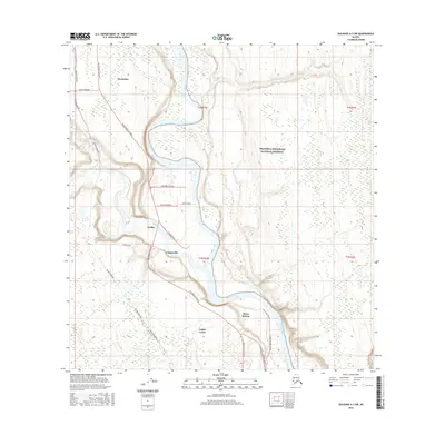
2016 Map of Gulkana A-3 SW
USGS Topo · Published 2016About this map
Glennallen and Tazlina anchor this Alaskan landscape where the Glenn Highway meets the Richardson Highway. The terrain is defined by the powerful convergence of the Tazlina River and the braided channels of the Copper River, which carve through the glacial outwash. To the east, the boundary of the Wrangell-Saint Elias National Preserve marks the edge of a massive protected wilderness.
Find a feature on this map
26 named features on this map. Tap any name to fly to it.
Don’t see what you’re looking for? This feature index may not catch every label — zoom into the map to look around manually.
Map Details
Editions of this 2016 Gulkana A-3 SW Map
This is the sole edition of this map. No revisions or reprints were ever made.
Other maps of this area

1948 · Valdez D-5
USGS Topo · 1:63,360

1949 · Gulkana A-3
USGS Topo · 1:63,360

1949 · Valdez D-4
USGS Topo · 1:63,360

1951 · Valdez D-5
USGS Topo · 1:63,360

1951 · Gulkana
USGS Topo · 1:250,000

1951 · Gulkana A-4
USGS Topo · 1:63,360

1952 · Gulkana A-3
USGS Topo · 1:63,360

1952 · Valdez
USGS Topo · 1:250,000

1952 · Valdez D-4
USGS Topo · 1:63,360

1952 · Gulkana A-4
USGS Topo · 1:63,360