
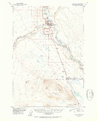
1952 Map of Valdez D-4
USGS Topo · Published 1952About this map
Copper Center serves as a focal point at the confluence of the Klutina River and the Copper River, where the Richardson Highway facilitates movement through the territory. This mid-century survey reveals a transition in land use, documenting several deactivated government sites including the U S School Reserve (Abandoned), an U S Experiment Station Reserve (Abandoned), and a U S Mil Res (Abandoned) south of the main U S Military Reservation. The presence of an Airfield and a Gaging Sta near the town center underscores the area's importance for transportation and environmental monitoring. The rugged terrain is punctuated by significant peaks like Stuck Mountain and Willow Mountain, while the Edgerton Cut-Off branches east toward the Nadina River. A notable survey detail is the Willow Creek Base Line established between the Willow Creek North Base and Willow Creek South Base.
Find a feature on this map
29 named features on this map. Tap any name to fly to it.
Don’t see what you’re looking for? This feature index may not catch every label — zoom into the map to look around manually.
Map Details
Editions of this 1952 Valdez D-4 Map
2 editions found
Other maps of this area

1948 · Valdez D-5
USGS Topo · 1:63,360

1949 · Gulkana A-3
USGS Topo · 1:63,360

1949 · Valdez D-4
USGS Topo · 1:63,360

1951 · Valdez D-5
USGS Topo · 1:63,360

1951 · Gulkana
USGS Topo · 1:250,000

1951 · Gulkana A-4
USGS Topo · 1:63,360

1951 · Valdez C-3
USGS Topo · 1:63,360

1951 · Valdez C-4
USGS Topo · 1:63,360

1951 · Valdez C-5
USGS Topo · 1:63,360

1952 · Gulkana A-3
USGS Topo · 1:63,360