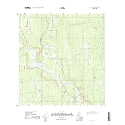
2019 Map of Gulkana A-3 SW
USGS Topo · Published 2019About this map
Tazlina and Copperville anchor this interior Alaska landscape where the Tazlina River joins the mighty Copper River. The infrastructure of the north is clearly visible through the transit of the Alaska Pipeline as it mirrors the path of the Richardson Highway and Glenn Highway. This convergence of roads and rivers defines the local settlement pattern, with neighborhoods like Tazlina Terrace and Silver Springs established along these primary corridors. To the east, the boundary of the Wrangell-St. Elias National Preserve marks the edge of vast protected wilderness. Local life is mapped through detailed local connectors such as School Road and Luebke Lane, providing a 2019 view of the residential development and road networks that sustain these Copper Valley communities.
Find a feature on this map
28 named features on this map. Tap any name to fly to it.
Don’t see what you’re looking for? This feature index may not catch every label — zoom into the map to look around manually.
Map Details
Editions of this 2019 Gulkana A-3 SW Map
This is the sole edition of this map. No revisions or reprints were ever made.
Other maps of this area

1948 · Valdez D-5
USGS Topo · 1:63,360

1949 · Gulkana A-3
USGS Topo · 1:63,360

1949 · Valdez D-4
USGS Topo · 1:63,360

1951 · Valdez D-5
USGS Topo · 1:63,360

1951 · Gulkana
USGS Topo · 1:250,000

1951 · Gulkana A-4
USGS Topo · 1:63,360

1952 · Gulkana A-3
USGS Topo · 1:63,360

1952 · Valdez
USGS Topo · 1:250,000

1952 · Valdez D-4
USGS Topo · 1:63,360

1952 · Gulkana A-4
USGS Topo · 1:63,360