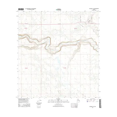
2016 Map of Gulkana A-4 SE
USGS Topo · Published 2016About this map
The Tazlina River meanders across this landscape, carved into a deep glacial valley with distinctive terrace levels that define the local topography. To the north, the Glenn Highway provides the primary transit corridor, serving a network of local residential and access roads. Small tributaries like Moose Cr and Nickel Cr feed into the main river system from the surrounding highlands. The map reveals a specific pattern of modern settlement along the highway corridor, where named thoroughfares such as College Road, Shoe Shoe Drive, and Mabel Lane cluster. This 2016 survey documents the expansion of infrastructure in the unorganized borough near Glennallen, illustrating how transportation and topography dictate the placement of human activity in this part of the Alaskan interior.
Find a feature on this map
14 named features on this map. Tap any name to fly to it.
Don’t see what you’re looking for? This feature index may not catch every label — zoom into the map to look around manually.
Map Details
Editions of this 2016 Gulkana A-4 SE Map
This is the sole edition of this map. No revisions or reprints were ever made.
Other maps of this area

1948 · Valdez D-5
USGS Topo · 1:63,360

1949 · Gulkana A-3
USGS Topo · 1:63,360

1949 · Valdez D-4
USGS Topo · 1:63,360

1951 · Valdez D-5
USGS Topo · 1:63,360

1951 · Gulkana
USGS Topo · 1:250,000

1951 · Gulkana A-4
USGS Topo · 1:63,360

1952 · Gulkana A-3
USGS Topo · 1:63,360

1952 · Valdez
USGS Topo · 1:250,000

1952 · Valdez D-4
USGS Topo · 1:63,360

1952 · Gulkana A-4
USGS Topo · 1:63,360