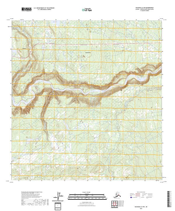
2023 Map of Gulkana A-4 SW
USGS Topo · Published 2023About this map
Glennallen and the surrounding Copper River basin are defined by the powerful course of the Tazlina River, which carves through the landscape in this modern US Topo survey. The Glenn Highway serves as the primary artery connecting the region, passing through Tolsona and leading toward the essential highway junction at Glennallen. The terrain is characterized by a complex network of wetlands and small water bodies, including Plumb Bob Lake, Mud Lake, and the curiously named Salt Spring. High-gradient drainage from tributaries like Nickel Creek and Durham Creek flows toward the glacial river system, illustrating the hydrology that governs travel and settlement patterns in this part of Alaska. This map provides an exceptionally clear view of the interface between established transport corridors and the persistent natural watercourses of the interior.
Find a feature on this map
14 named features on this map. Tap any name to fly to it.
Don’t see what you’re looking for? This feature index may not catch every label — zoom into the map to look around manually.
Map Details
Editions of this 2023 Gulkana A-4 SW Map
This is the sole edition of this map. No revisions or reprints were ever made.
Other maps of this area

1948 · Valdez D-5
USGS Topo · 1:63,360

1949 · Gulkana A-5
USGS Topo · 1:63,360

1949 · Valdez D-6
USGS Topo · 1:63,360

1951 · Valdez D-5
USGS Topo · 1:63,360

1951 · Gulkana
USGS Topo · 1:250,000

1951 · Valdez D-6
USGS Topo · 1:63,360

1951 · Gulkana A-4
USGS Topo · 1:63,360

1952 · Valdez
USGS Topo · 1:250,000

1952 · Gulkana A-5
USGS Topo · 1:63,360

1952 · Gulkana A-4
USGS Topo · 1:63,360