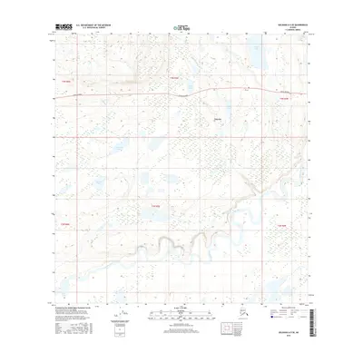
2016 Map of Gulkana A-5 SE
USGS Topo · Published 2016About this map
Tolsona and its surrounding wetlands occupy a landscape defined by the winding course of the Tazlina River and a dense network of subarctic lakes. Situated in the Copper River Basin, the settlement is positioned along the Glenn Highway, a vital corridor through the interior. The hydrology of the area is exceptionally complex, featuring numerous named water bodies including Tolsona Lake, Lost Cabin Lake, and McLeod Lake. The map reveals how the river meanders through the lower terrain, while several creeks like Atlasta Cr and Little Woods Cr drain the higher elevations. This topography illustrates the intersection of primary transportation routes with the challenging terrain of the Alaska interior, where the Tazlina Lake shoreline begins to emerge in the southwestern reaches of the quadrangle.
Find a feature on this map
18 named features on this map. Tap any name to fly to it.
Don’t see what you’re looking for? This feature index may not catch every label — zoom into the map to look around manually.
Map Details
Editions of this 2016 Gulkana A-5 SE Map
This is the sole edition of this map. No revisions or reprints were ever made.
Other maps of this area

1949 · Gulkana A-5
USGS Topo · 1:63,360

1949 · Valdez D-6
USGS Topo · 1:63,360

1949 · Valdez D-7
USGS Topo · 1:63,360

1951 · Gulkana
USGS Topo · 1:250,000

1951 · Valdez D-6
USGS Topo · 1:63,360

1951 · Valdez D-7
USGS Topo · 1:63,360

1951 · Gulkana A-4
USGS Topo · 1:63,360

1952 · Valdez
USGS Topo · 1:250,000

1952 · Gulkana A-5
USGS Topo · 1:63,360

1952 · Gulkana A-4
USGS Topo · 1:63,360