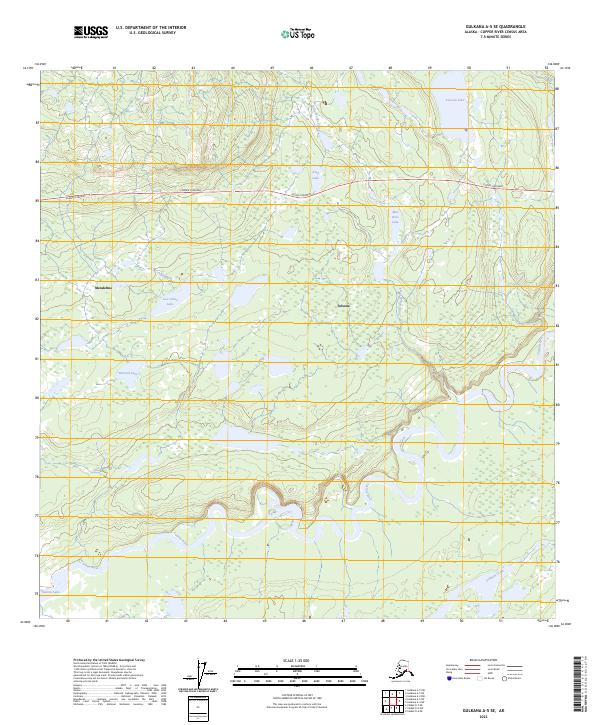
2023 Map of Gulkana A-5 SE
USGS Topo · Published 2023About this map
Tolsona and Mendeltna serve as the primary human touchpoints in this interior landscape, where the Glenn Highway cuts a path through a dense network of subarctic wetlands and lakes. The terrain is defined by the winding course of the Tazlina River in the south, which drains a complex system of smaller tributaries and still waters. This region's character is shaped by its hydrology, where named bodies of water like Mae West Lake, Tolsona Lake, and McLeod Lake are connected by slow-moving drainages such as Little Woods Creek and Atlanta Creek. The presence of labels like Lost Cabin Lake hints at a history of trapping or early Alaskan homesteading, while the broad extent of the Tazlina Lake shoreline at the southwestern corner suggests the significant scale of the glacial-fed systems that dominate the Copper River basin.
Find a feature on this map
19 named features on this map. Tap any name to fly to it.
Don’t see what you’re looking for? This feature index may not catch every label — zoom into the map to look around manually.
Map Details
Editions of this 2023 Gulkana A-5 SE Map
This is the sole edition of this map. No revisions or reprints were ever made.
Other maps of this area

1949 · Gulkana A-5
USGS Topo · 1:63,360

1949 · Valdez D-6
USGS Topo · 1:63,360

1949 · Valdez D-7
USGS Topo · 1:63,360

1951 · Gulkana
USGS Topo · 1:250,000

1951 · Valdez D-6
USGS Topo · 1:63,360

1951 · Valdez D-7
USGS Topo · 1:63,360

1951 · Gulkana A-4
USGS Topo · 1:63,360

1952 · Valdez
USGS Topo · 1:250,000

1952 · Gulkana A-5
USGS Topo · 1:63,360

1952 · Gulkana A-4
USGS Topo · 1:63,360