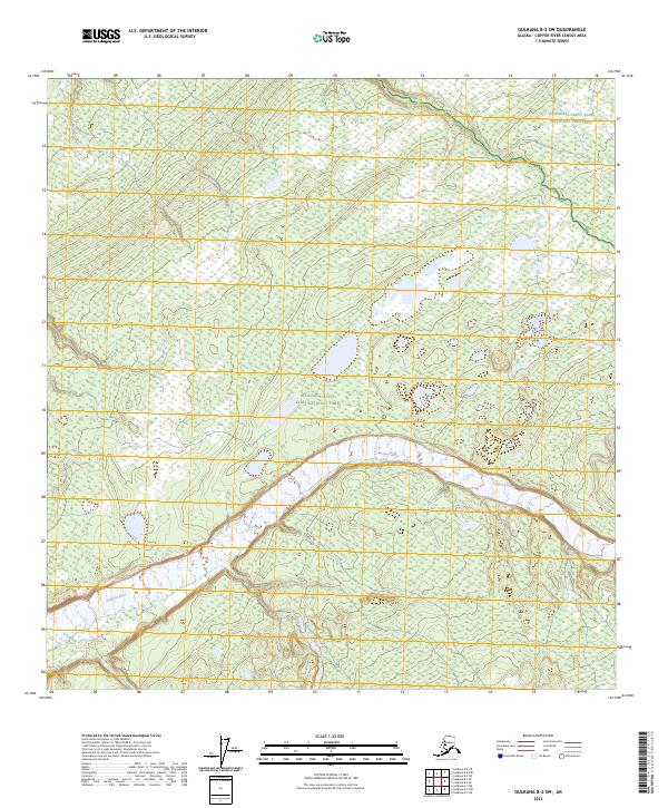
2023 Map of Gulkana B-2 SW
USGS Topo · Published 2023About this map
The Sanford River winds through the heart of this landscape, carving a wide braided channel across the terrain. This portion of the Copper River Census Area is defined by its transition between protected wilderness zones, split between the Wrangell-Saint Elias National Park and the adjacent Wrangell-Saint Elias National Preserve. The map illustrates a largely unpopulated expanse where the natural hydrology of the river system dictates the land's character. Topographic details reveal a complex network of wetlands and small ponds scattered throughout the northern sections, particularly within the boundaries of Wrangell-Saint Elias National Park. This survey provides a modern look at the preservation of these subarctic ecosystems, showing the vast and relatively undisturbed state of the eastern Alaska interior in the early twenty-first century.
Find a feature on this map
9 named features on this map. Tap any name to fly to it.
Don’t see what you’re looking for? This feature index may not catch every label — zoom into the map to look around manually.
Map Details
Editions of this 2023 Gulkana B-2 SW Map
This is the sole edition of this map. No revisions or reprints were ever made.
Other maps of this area

1949 · Gulkana A-3
USGS Topo · 1:63,360

1949 · Gulkana B-2
USGS Topo · 1:63,360

1950 · Gulkana B-3
USGS Topo · 1:63,360

1951 · Gulkana
USGS Topo · 1:250,000

1952 · Gulkana A-3
USGS Topo · 1:63,360

1952 · Gulkana B-3
USGS Topo · 1:63,360

1952 · Gulkana B-2
USGS Topo · 1:63,360
1959 · Gulkana A-2
USGS Topo · 1:63,360

1959 · Gulkana
USGS Topo · 1:250,000

1965 · Gulkana
USGS Topo · 1:250,000