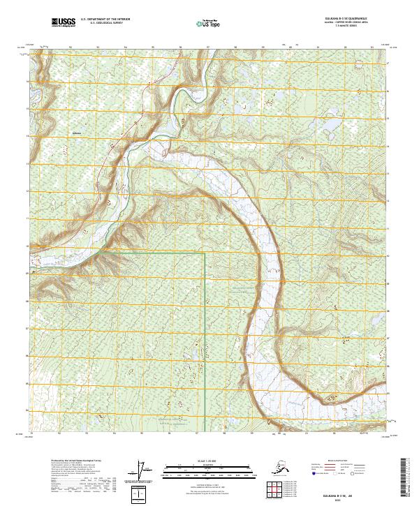
2023 Map of Gulkana B-3 SE
USGS Topo · Published 2023About this map
Gakona sits at the northern edge of a wide river junction where the Gakona River meets the silty, braided channels of the Copper River. This 2023 survey illustrates the dramatic fluvial landscape of the Copper River Basin, where the expansive gravel beds of the Sanford River sweep in from the east. The terrain is defined by the transition from the active floodplains to the protected wilderness of the Wrangell-Saint Elias National Park and the adjacent Wrangell-Saint Elias National Preserve. The Tok Cutoff Highway provides the primary overland connection through this region, following the high ground west of the river systems. The map detail highlights the complex network of wetlands and seasonal ponds that characterize the interior plateau, offering a precise look at the hydrology of the eastern Gulkana area.
Find a feature on this map
11 named features on this map. Tap any name to fly to it.
Don’t see what you’re looking for? This feature index may not catch every label — zoom into the map to look around manually.
Map Details
Editions of this 2023 Gulkana B-3 SE Map
This is the sole edition of this map. No revisions or reprints were ever made.
Other maps of this area

1949 · Gulkana A-3
USGS Topo · 1:63,360

1949 · Gulkana B-2
USGS Topo · 1:63,360

1950 · Gulkana B-3
USGS Topo · 1:63,360

1951 · Gulkana
USGS Topo · 1:250,000

1952 · Gulkana A-3
USGS Topo · 1:63,360

1952 · Gulkana B-3
USGS Topo · 1:63,360

1952 · Gulkana B-2
USGS Topo · 1:63,360
1959 · Gulkana A-2
USGS Topo · 1:63,360

1959 · Gulkana
USGS Topo · 1:250,000

1965 · Gulkana
USGS Topo · 1:250,000