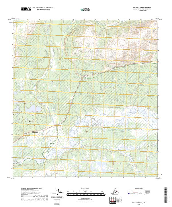
2023 Map of Gulkana C-1 NW
USGS Topo · Published 2023About this map
Chistochina serves as a central point of settlement in this interior landscape, positioned along the vital Tok Cutoff Highway. The terrain is defined by the powerful southward flow of the Copper River, which receives drainage from northern tributaries including Indian Creek and the East Fork Indian Creek. Large portions of the eastern territory are protected within the Wrangell-Saint Elias National Preserve, indicating a transition from managed roadside infrastructure to vast conservation lands. The presence of the Indian Creek Trl suggests long-established routes through the drainage basins, connecting the highway corridor to the higher elevations and remote reaches of the preserve.
Find a feature on this map
11 named features on this map. Tap any name to fly to it.
Don’t see what you’re looking for? This feature index may not catch every label — zoom into the map to look around manually.
Map Details
Editions of this 2023 Gulkana C-1 NW Map
This is the sole edition of this map. No revisions or reprints were ever made.
Other maps of this area

1949 · Gulkana C-2
USGS Topo · 1:63,360

1949 · Gulkana C-1
USGS Topo · 1:63,360

1951 · Gulkana
USGS Topo · 1:250,000

1952 · Gulkana C-2
USGS Topo · 1:63,360

1952 · Gulkana C-1
USGS Topo · 1:63,360
1954 · Gulkana D-2
USGS Topo · 1:63,360
1954 · Gulkana D-1
USGS Topo · 1:63,360

1959 · Gulkana
USGS Topo · 1:250,000

1965 · Gulkana
USGS Topo · 1:250,000
2016 · Gulkana D-1 SE
USGS Topo · 1:25,000