
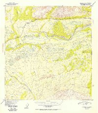
1952 Map of Gulkana C-1
USGS Topo · Published 1952About this map
The Copper River dominates this mid-century Alaskan landscape, cutting a wide braided path through a region defined by its complex hydrology and glacial terrain. Just after the war, this survey captures the critical infrastructure of the Glenn Highway as it skirts the northern hills, providing a vital overland link through the interior. Near the western edge, the small settlement of Indian River sits at the confluence where Indian Creek meets the main river channel, marking one of the few named points of human habitation in the area.
Find a feature on this map
11 named features on this map. Tap any name to fly to it.
Don’t see what you’re looking for? This feature index may not catch every label — zoom into the map to look around manually.
Map Details
Editions of this 1952 Gulkana C-1 Map
2 editions found
Other maps of this area

1948 · Nabesna C-6
USGS Topo · 1:63,360

1949 · Gulkana C-2
USGS Topo · 1:63,360

1949 · Nabesna D-6
USGS Topo · 1:63,360

1949 · Gulkana B-2
USGS Topo · 1:63,360

1949 · Gulkana C-1
USGS Topo · 1:63,360

1950 · Nabesna
USGS Topo · 1:250,000

1951 · Gulkana
USGS Topo · 1:250,000

1951 · Nabesna
USGS Topo · 1:250,000

1952 · Nabesna C-6
USGS Topo · 1:63,360

1952 · Gulkana B-2
USGS Topo · 1:63,360