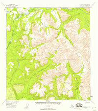
1954 Map of Gulkana D-1
USGS Topo · Published 1958About this map
Mankomen Lake sits at the northwestern edge of this 1950s survey, marking a pocket of accessible water in a region defined by high mountain ridges and river forks. The drainage patterns of the Chistochina River and the Slana River dictate the movement through this landscape, with travel restricted to the high passes and a single Tractor Trail that skirts the northern boundary. Near the confluence of Quartz Creek and Granite Creek, a lone Mine and associated Cabin indicate isolated mineral exploration in the shadow of The Dome. The presence of an Airstrip near the lake highlights the reliance on bush pilots for transport and supply in an area where developed roads are non-existent. These features reveal a mid-century wilderness where subsistence and extraction depended on river systems like Indian Creek and narrow overland paths.
Find a feature on this map
18 named features on this map. Tap any name to fly to it.
Don’t see what you’re looking for? This feature index may not catch every label — zoom into the map to look around manually.
Map Details
Editions of this 1954 Gulkana D-1 Map
3 editions found
Other maps of this area

1948 · Tanacross A-6
USGS Topo · 1:63,360

1948 · Nabesna C-6
USGS Topo · 1:63,360

1949 · Tanacross
USGS Topo · 1:250,000

1949 · Gulkana C-2
USGS Topo · 1:63,360

1949 · Nabesna D-6
USGS Topo · 1:63,360

1949 · Gulkana C-1
USGS Topo · 1:63,360

1949 · Mt. Hayes A-1
USGS Topo · 1:63,360

1950 · Tanacross
USGS Topo · 1:250,000

1950 · Nabesna
USGS Topo · 1:250,000

1950 · Mount Hayes
USGS Topo · 1:250,000