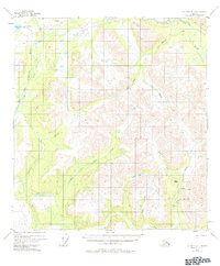
1954 Map of Gulkana D-1
USGS Topo · Published 1984About this map
The Chistochina River and the Slana River define the drainage patterns of this Alaskan interior landscape as it was documented in the mid-1950s. The region is characterized by remote bush infrastructure, including a Landing Strip and a Tractor Trail that provided essential access to high-altitude terrain and isolated outposts. Notable landmarks such as The Dome rise above the complex network of waterways, where the Indian Creek and its East Fork join larger systems. Traces of human activity are concentrated near mineral interests, evidenced by a Mine and a Cabin located near Grubstake Creek. This 1954 data, later revised in 1978, illustrates a landscape where early aviation and rough trails were the primary links between glacial-fed rivers and remote alpine lakes like Mankomen Lake.
Find a feature on this map
18 named features on this map. Tap any name to fly to it.
Don’t see what you’re looking for? This feature index may not catch every label — zoom into the map to look around manually.
Map Details
Editions of this 1954 Gulkana D-1 Map
3 editions found
Other maps of this area

1948 · Tanacross A-6
USGS Topo · 1:63,360

1948 · Nabesna C-6
USGS Topo · 1:63,360

1949 · Tanacross
USGS Topo · 1:250,000

1949 · Gulkana C-2
USGS Topo · 1:63,360

1949 · Nabesna D-6
USGS Topo · 1:63,360

1949 · Gulkana C-1
USGS Topo · 1:63,360

1949 · Mt. Hayes A-1
USGS Topo · 1:63,360

1950 · Tanacross
USGS Topo · 1:250,000

1950 · Nabesna
USGS Topo · 1:250,000

1950 · Mount Hayes
USGS Topo · 1:250,000