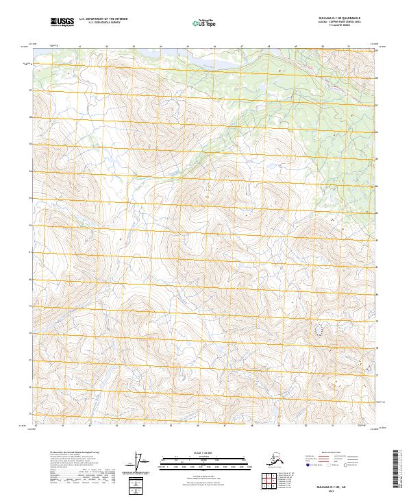
2023 Map of Gulkana D-1 NE
USGS Topo · Published 2023About this map
Slana River drainage defines the northern reaches of this Alaskan interior landscape, where the Slana River Trl follows the watercourse along the base of steep mountain ridges. The terrain is characterized by a complex network of glacial and snow-melt tributaries, including Granite Creek and the West Fork Granite Creek, which carve deep valleys through the high country. In the southern portion of the quadrangle, the headwaters of the East Fork Indian Creek and Ahtell Creek indicate a shift in the local watershed. This 2023 survey by the U.S. Geological Survey provides an intricate look at the hydrology of the Copper River Census Area, illustrating how the West Fork Ahtell Creek and its neighboring streams dictate the only viable passages through this wilderness.
Find a feature on this map
11 named features on this map. Tap any name to fly to it.
Don’t see what you’re looking for? This feature index may not catch every label — zoom into the map to look around manually.
Map Details
Editions of this 2023 Gulkana D-1 NE Map
This is the sole edition of this map. No revisions or reprints were ever made.
Other maps of this area

1948 · Tanacross A-6
USGS Topo · 1:63,360

1949 · Tanacross
USGS Topo · 1:250,000

1949 · Nabesna D-6
USGS Topo · 1:63,360

1949 · Mt. Hayes A-1
USGS Topo · 1:63,360

1950 · Tanacross
USGS Topo · 1:250,000

1950 · Nabesna
USGS Topo · 1:250,000

1950 · Mount Hayes
USGS Topo · 1:250,000

1951 · Gulkana
USGS Topo · 1:250,000

1951 · Mount Hayes
USGS Topo · 1:250,000

1951 · Nabesna
USGS Topo · 1:250,000