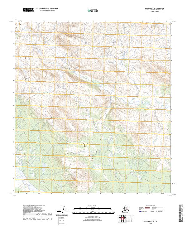
2023 Map of Gulkana D-3 NE
USGS Topo · Published 2023About this map
Gakona River flows through the southwestern corner of this landscape, its wide drainage contrasting with the narrower headwaters of Excelsior Creek. This area of the Copper River Census Area is defined by high-elevation terrain where numerous small wetlands and tarns dot the lower slopes between significant ridges. The map meticulously documents the intersection of several township lines, including t22s r13e and t14n r1e, marking a complex convergence of terrestrial survey boundaries in this interior region. The drainage patterns of the Excelsior Creek basin illustrate the hydrologic network feeding into larger Alaskan river systems, providing a clear view of the natural topography before any significant modern road infrastructure reached this specific section.
Find a feature on this map
8 named features on this map. Tap any name to fly to it.
Don’t see what you’re looking for? This feature index may not catch every label — zoom into the map to look around manually.
Map Details
Editions of this 2023 Gulkana D-3 NE Map
This is the sole edition of this map. No revisions or reprints were ever made.
Other maps of this area

1949 · Gulkana D-3
USGS Topo · 1:63,360

1950 · Mount Hayes
USGS Topo · 1:250,000

1950 · Mount Hayes A-3
USGS Topo · 1:63,360

1951 · Gulkana
USGS Topo · 1:250,000

1951 · Mount Hayes
USGS Topo · 1:250,000

1952 · Gulkana D-3
USGS Topo · 1:63,360

1952 · Mount Hayes A-3
USGS Topo · 1:63,360
1954 · Gulkana D-2
USGS Topo · 1:63,360
1954 · Gulkana D-3
USGS Topo · 1:63,360
1954 · Mount Hayes A-3
USGS Topo · 1:63,360