
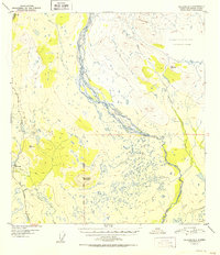
1952 Map of Gulkana D-3
USGS Topo · Published 1952About this map
The Gakona River carves a braided path through this interior landscape, meeting the Copper River in an area of complex water systems and high-altitude terrain. Early post-war infrastructure is centered around the Richardson Highway, which serves as the primary artery for the region. Travelers and residents in 1949 relied on the Meier Lodge near the banks of Gillespie Creek for services along this vital route.
Find a feature on this map
16 named features on this map. Tap any name to fly to it.
Don’t see what you’re looking for? This feature index may not catch every label — zoom into the map to look around manually.
Map Details
Editions of this 1952 Gulkana D-3 Map
2 editions found
Other maps of this area

1949 · Mount Hayes A-4
USGS Topo · 1:63,360

1949 · Gulkana C-2
USGS Topo · 1:63,360

1949 · Gulkana D-3
USGS Topo · 1:63,360

1950 · Mount Hayes
USGS Topo · 1:250,000

1950 · Gulkana D-4
USGS Topo · 1:63,360

1950 · Mount Hayes A-3
USGS Topo · 1:63,360

1950 · Gulkana C-3
USGS Topo · 1:63,360

1950 · Gulkana C-4
USGS Topo · 1:63,360

1951 · Gulkana
USGS Topo · 1:250,000

1951 · Mount Hayes
USGS Topo · 1:250,000