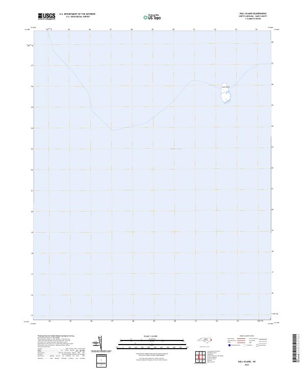
2022 Map of Gull Island
USGS Topo · Published 2022About this map
Pamlico Sound dominates this coastal survey, where the shallow waters of the Outer Banks stretch across the vast majority of the quadrangle. The primary geographic landmark is Gull Island, a small, isolated landmass standing amidst the estuary's expansive waters. In this recent charting by the U.S. Geological Survey, the isolation of the island is clearly documented, illustrating its position as a solitary point of reference for maritime navigation or wildlife within the sound. Because the area is almost entirely aquatic, the map provides a precise contemporary record of the island's shoreline and position before the shifting tides and storm surges common to the North Carolina coast alter its profile.
Find a feature on this map
3 named features on this map. Tap any name to fly to it.
Don’t see what you’re looking for? This feature index may not catch every label — zoom into the map to look around manually.
Map Details
Editions of this 2022 Gull Island Map
This is the sole edition of this map. No revisions or reprints were ever made.
Other maps of this area

1943 · Roanoke Island
USGS Topo · 1:125,000

1948 · Buxton
USGS Topo · 1:24,000

1950 · Buxton
USGS Topo · 1:24,000

1955 · Wanchese
USGS Topo · 1:250,000

1957 · Manteo
USGS Topo · 1:250,000

1960 · Manteo
USGS Topo · 1:250,000

1985 · Cape Hatteras
USGS Topo · 1:100,000

1985 · Manteo
USGS Topo · 1:100,000

2011 · Buxton
USGS Topo · 1:24,000
2011 · Long Shoal Point OE E
USGS Topo · 1:24,000