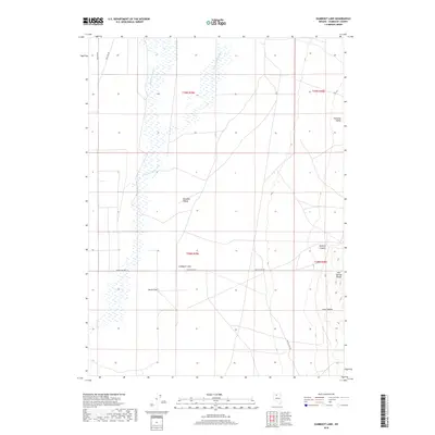
2018 Map of Gumboot Lake
USGS Topo · Published 2018About this map
Paradise Valley and the surrounding high desert of Humboldt County are defined by a network of seasonal watercourses and expansive flats in this 2018 survey. The eponymous Gumboot Lake sits at the center of the quadrangle, a focal point in a landscape marked by the Little Humboldt River and Big Cottonwood Cr. The eastern portion of the map is dominated by the rising terrain of the Hot Springs Range, where features like Sodarisi Canyon and Long Canyon cut through the upland slopes. This area maintains a sparse, ranching-oriented infrastructure, anchored by routes like Dutch Flat Rd and the localized settlement area at Dutch Flat. The mapping of these drainages and seasonal lake beds reveals the delicate hydrological patterns essential to life and land use in this part of northern Nevada.
Find a feature on this map
15 named features on this map. Tap any name to fly to it.
Don’t see what you’re looking for? This feature index may not catch every label — zoom into the map to look around manually.
Map Details
Editions of this 2018 Gumboot Lake Map
This is the sole edition of this map. No revisions or reprints were ever made.
Other maps of this area

1882 · Paradise
USGS Topo · 1:250,000

1893 · Paradise
USGS Topo · 1:250,000

1945 · Osgood Mountains
USGS Topo · 1:62,500

1945 · Hot Springs
USGS Topo · 1:62,500

1947 · Osgood Mountains
USGS Topo · 1:62,500

1947 · Hot Springs Peak
USGS Topo · 1:62,500

1955 · McDermitt
USGS Topo · 1:250,000

1958 · Paradise Valley
USGS Topo · 1:62,500

1959 · McDermitt
USGS Topo · 1:250,000

1959 · Bliss
USGS Topo · 1:62,500