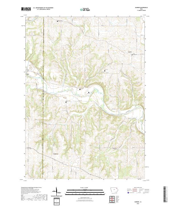
2022 Map of Gunder
USGS Topo · Published 2022About this map
The settlement of Gunder anchors the northeast corner of this agricultural survey, characterized by the deeply carved valley of the Turkey River as it winds through the western landscape toward Elgin. The terrain is a network of ridges and drainages including Dry Run, Sand Cr, and Beaver Cr, which shape the rural road system. This area of Clayton County is notable for its concentrated heritage sites, particularly the numerous family and congregational burial grounds that dot the countryside. Researchers can locate the East Clermont Lutheran Cem, Marion Lutheran Cem, and the Apostolic Cem, alongside several smaller plots like Cook Cem and Mork Cem. In the south, the community of Highland sits near the Highland Lutheran Cem, illustrating the importance of these church-centered nodes in the local social geography. The intricate contour lines reveal the transition from high farm plateaus to the steep slopes of the river breaks.
Find a feature on this map
59 named features on this map. Tap any name to fly to it.
Don’t see what you’re looking for? This feature index may not catch every label — zoom into the map to look around manually.
Map Details
Editions of this 2022 Gunder Map
This is the sole edition of this map. No revisions or reprints were ever made.
Other maps of this area

1901 · Oelwein
USGS Topo · 1:125,000

1902 · Elkader
USGS Topo · 1:125,000

1903 · Waukon
USGS Topo · 1:125,000

1906 · Decorah
USGS Topo · 1:125,000

1958 · La Crosse
USGS Topo · 1:250,000

1959 · Dubuque
USGS Topo · 1:250,000

1961 · Dubuque
USGS Topo · 1:250,000

1961 · La Crosse
USGS Topo · 1:250,000

1962 · Dubuque
USGS Topo · 1:250,000
1964 · Elkader
USGS Topo · 1:24,000