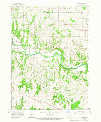
1965 Map of Gunder
USGS Topo · Published 1966About this map
The Turkey River carves a deep, winding path through the northeast Iowa countryside, defining the rural character of this mid-1960s landscape. Near the western edge of the sheet, Elgin sits at the confluence of several valley systems, while the smaller settlement of Gunder anchors the eastern highlands. This area is characterized by a strong network of country congregations and burial grounds that reflect the region's cultural heritage, including the East Clermont Ch and the Highland Ch near the southern border. The map shows a landscape transitioning between forested slopes and plateau farmland, with numerous quarries and springs scattered across the townships of Marion and Grand Meadow. Genealogists may find the exact locations of the Houg Cem and Apostolic Cem particularly valuable for tracing local family histories in this corner of Clayton and Fayette counties.
Find a feature on this map
25 named features on this map. Tap any name to fly to it.
Don’t see what you’re looking for? This feature index may not catch every label — zoom into the map to look around manually.
Map Details
Editions of this 1965 Gunder Map
This is the sole edition of this map. No revisions or reprints were ever made.
Other maps of this area

1901 · Oelwein
USGS Topo · 1:125,000

1902 · Elkader
USGS Topo · 1:125,000

1903 · Waukon
USGS Topo · 1:125,000

1906 · Decorah
USGS Topo · 1:125,000

1958 · La Crosse
USGS Topo · 1:250,000

1959 · Dubuque
USGS Topo · 1:250,000

1961 · Dubuque
USGS Topo · 1:250,000

1961 · La Crosse
USGS Topo · 1:250,000

1962 · Dubuque
USGS Topo · 1:250,000
1964 · Elkader
USGS Topo · 1:24,000