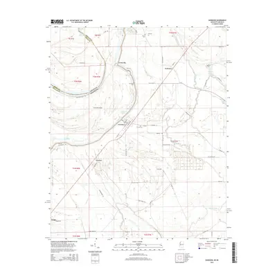
2015 Map of Gunnison
USGS Topo · Published 2015About this map
Gunnison stands as a central settlement in this portion of the Mississippi Delta, surrounded by a complex network of bayous and oxbow lakes that define the shifting border with Arkansas. The landscape is marked by the presence of Concordia Island and the expansive Old River Lake, illustrating the historical path of the Mississippi River before modern levee systems altered its course. Smaller rural communities like Perthshire, Waxhaw, and Concordia are connected by a grid of agricultural roads such as Gibson Swamp Rd and Warfield Rd, reflecting the region’s deep ties to cotton and river-based commerce. For genealogists and local historians, several family and community burial sites are documented, including Gunnison Cem, Concordia Cem, and Scott Cem. The eastern portion of the sheet is dominated by the meandering Bogue Phalia, which drains the low-lying terrain north toward Stamps Lake.
Find a feature on this map
65 named features on this map. Tap any name to fly to it.
Don’t see what you’re looking for? This feature index may not catch every label — zoom into the map to look around manually.
Map Details
Editions of this 2015 Gunnison Map
This is the sole edition of this map. No revisions or reprints were ever made.
Other maps of this area

1930 · Mellwood
USGS Topo · 1:62,500

1939 · Henrico
USGS Topo · 1:62,500

1939 · Pace
USGS Topo · 1:62,500

1939 · Big Island
USGS Topo · 1:62,500

1939 · Mellwood
USGS Topo · 1:62,500

1948 · Helena
USGS Topo · 1:250,000

1950 · Helena
USGS Topo · 1:250,000

1953 · Greenwood
USGS Topo · 1:250,000

1954 · Mellwood
USGS Topo · 1:62,500

1954 · Henrico
USGS Topo · 1:62,500