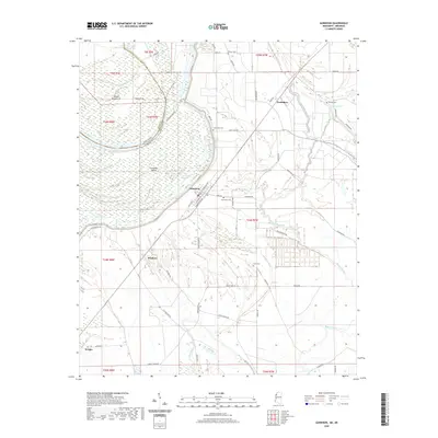
2020 Map of Gunnison
USGS Topo · Published 2020About this map
Gunnison and its surrounding delta lowlands are defined by the winding course of the Mississippi River and its intricate network of former channels and bayous. In this 2020 map, the landscape reflects a tradition of riverfront settlement and agriculture, where the state line between the Arkansas Mississippi border meanders across Island Number 71 and Concordia Island, following the historic path of the water. Local history and genealogy are anchored by several small burial grounds across the flats, including Person Cem, Pickett Cem, and the Scott Cem near the banks of the Bogue Phalia. The small community of Perthshire stands to the north, while the grid of Gunnison remains a central point for local travel along routes like Main St and Railroad Ave. Extensive wetlands and oxbows such as Upper Old River Lake and Lake Concordia demonstrate the persistent influence of the river's hydrology on the region's development.
Find a feature on this map
64 named features on this map. Tap any name to fly to it.
Don’t see what you’re looking for? This feature index may not catch every label — zoom into the map to look around manually.
Map Details
Editions of this 2020 Gunnison Map
This is the sole edition of this map. No revisions or reprints were ever made.
Other maps of this area

1930 · Mellwood
USGS Topo · 1:62,500

1939 · Henrico
USGS Topo · 1:62,500

1939 · Pace
USGS Topo · 1:62,500

1939 · Big Island
USGS Topo · 1:62,500

1939 · Mellwood
USGS Topo · 1:62,500

1948 · Helena
USGS Topo · 1:250,000

1950 · Helena
USGS Topo · 1:250,000

1953 · Greenwood
USGS Topo · 1:250,000

1954 · Mellwood
USGS Topo · 1:62,500

1954 · Henrico
USGS Topo · 1:62,500