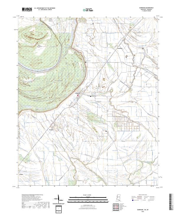
2024 Map of Gunnison
USGS Topo · Published 2024About this map
Gunnison and Perthshire serve as the primary nodes of settlement along the eastern side of the Mississippi River oxbows in this contemporary survey of Bolivar County. The landscape is defined by the alluvial plains of the Delta, where the meandering paths of Bogue Phalia and its tributary Upper Bogue cut through a dense network of agricultural roads and drainage channels. The shifting nature of the river is evident in the presence of large landforms like Concordia Island and Island Number Seventy, which remain separated from the main channel by Old River Lake and Upper Old River Lake. Local heritage is preserved through numerous family and community burial grounds, including Scott Cem, Pickett Cem, and Person Cem. Tracing the grid of Railroad Ave in Gunnison or the scattered homesites near Waxhaw reveals a deep-rooted pattern of rural life shaped by the fertile but flood-prone soil of the river basin.
Find a feature on this map
65 named features on this map. Tap any name to fly to it.
Don’t see what you’re looking for? This feature index may not catch every label — zoom into the map to look around manually.
Map Details
Editions of this 2024 Gunnison Map
This is the sole edition of this map. No revisions or reprints were ever made.
Other maps of this area

1930 · Mellwood
USGS Topo · 1:62,500

1939 · Henrico
USGS Topo · 1:62,500

1939 · Pace
USGS Topo · 1:62,500

1939 · Big Island
USGS Topo · 1:62,500

1939 · Mellwood
USGS Topo · 1:62,500

1948 · Helena
USGS Topo · 1:250,000

1950 · Helena
USGS Topo · 1:250,000

1953 · Greenwood
USGS Topo · 1:250,000

1954 · Mellwood
USGS Topo · 1:62,500

1954 · Henrico
USGS Topo · 1:62,500