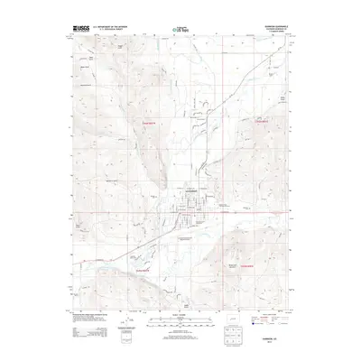
2013 Map of Gunnison
USGS Topo · Published 2013About this map
Gunnison sits at the confluence of the Gunnison River and Tomichi Creek, serving as a high-altitude hub for education and aviation in the early 21st century. The town is anchored by the campus of Western State Colorado University on its eastern edge and the Gunnison-Crested Butte Regional Airport to the south. The landscape is defined by its water management systems, including the Gunnison Highline Canal and various irrigation ditches like the May Bohm Ditch and Lone Pine Ditch, which support local agriculture and ranching operations such as Thornton Ranch. Surrounding the valley floor are numerous gulches and prominent landforms, most notably Tenderfoot Mountain which overlooks the city. Historical sites are preserved at Palisade Cem and Gunnison Cem, while the Gunnison County Fairgrounds serves as a center for community gatherings and regional events.
Find a feature on this map
67 named features on this map. Tap any name to fly to it.
Don’t see what you’re looking for? This feature index may not catch every label — zoom into the map to look around manually.
Map Details
Editions of this 2013 Gunnison Map
This is the sole edition of this map. No revisions or reprints were ever made.
Other maps of this area

1908 · Uncompahgre
USGS Topo · 1:125,000

1911 · Uncompahgre
USGS Topo · 1:125,000

1954 · Iris NW
USGS Topo · 1:24,000

1954 · Iola
USGS Topo · 1:24,000

1954 · Mc Intosh Mountain
USGS Topo · 1:24,000

1954 · Gunnison
USGS Topo · 1:24,000

1956 · Montrose
USGS Topo · 1:250,000

1959 · Montrose
USGS Topo · 1:250,000

1960 · Montrose
USGS Topo · 1:250,000

1962 · Iris
USGS Topo · 1:24,000