
1893 Map of Gunpowder
USGS Topo · Published 1893About this map
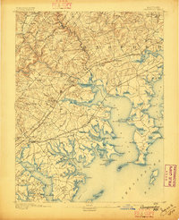
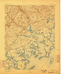
Jerusalem Mills and the Spoke Factory stand as primary industrial landmarks along the waterways of Baltimore and Harford Counties during the late nineteenth century. This landscape is defined by the complex drainage systems of the Gunpowder River and Bush River, where the tidal estuaries meet a network of inland mills and early manufacturing sites. The map reveals a transition from the coastal environments of Chesapeake Bay to the rising terrain of the interior, punctuated by established settlements like White Marsh (Cowenton) and Kingsville.
Find a feature on this map
122 named features on this map. Tap any name to fly to it.
Don’t see what you’re looking for? This feature index may not catch every label — zoom into the map to look around manually.
Map Details
Editions of this 1893 Gunpowder Map
3 editions found
Other maps of this area

1893 · North Point
USGS Topo · 1:62,500

1894 · Baltimore
USGS Topo · 1:62,500

1894 · Relay
USGS Topo · 1:62,500

1898 · Tolchester
USGS Topo · 1:125,000

1899 · Baltimore
USGS Topo · 1:62,500

1900 · Havre De Grace
USGS Topo · 1:62,500

1900 · Betterton
USGS Topo · 1:62,500

1900 · Parkton
USGS Topo · 1:62,500

1901 · Belair
USGS Topo · 1:62,500

1901 · Chestertown
USGS Topo · 1:62,500